Sites
Karun
Written by: Mohsen Shirmuhammad,
Translated by: Hadi Qorbanyar
158 Views
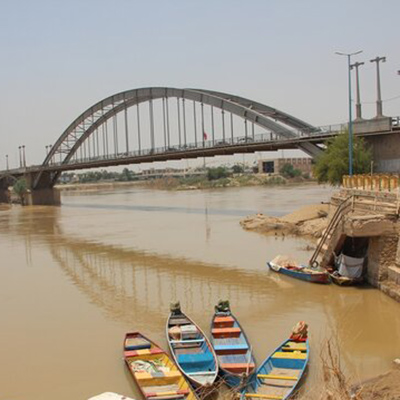
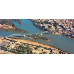
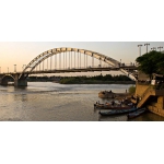
Karun is the largest river in Iran, which flows through Khuzestan Province. In the course of the Iran–Iraq War, it became a site of frequent military confrontations. Stretching about 850 kilometers, Karun is the longest river in Iran and one of Khuzestan’s most important natural and strategic features. The Karun rises in the Armand, Bazoft, and Cheshmeh-Deimeh in the Zard Kuh mountains of the Bakhtiari district (Chaharmahal and Bakhtiari Province), receiving many tributaries, such as the Kharsan River (Dena Mountains in Kohgiluyeh and Boyer-Ahmad Province) and the Dez River (Lorestan Highlands).
After flowing through several mountain ridges, the river enters the Khuzestan plain at a place called Gotvand. Near Shoushtar, Karun splits into two branches, which merge again south of the city. Its most important tributary is the Dez River, which joins it north of Ahvaz.
In the past, the Karun flowed directly into the Persian Gulf, about four kilometers north of the Arvand Rud. However, during the reign of Azod al-Dowleh Deylami (935–982), the Azodi Canal was dug in Khorramshahr, dividing the Karun into two branches:[1] one called Bahmanshir, running north of Abadan parallel to the Arvand Rud and emptying into the Persian Gulf, and the other still known as Karun, or the Azodi Canal, flowing south of Khorramshahr into the Arvand Rud.
The river’s width varies from one location to another, measuring around 150 meters in some areas and between 200 to 250 meters in others. The Karun joins the Arvand Rud on the Iran–Iraq border before flowing into the Persian Gulf. Its meandering course has turned Khuzestan into a vast, fertile plain. Several dams have been built along the river, the most important of which are Karun 1, Karun 3, Karun 4, Masjed Soleiman, and, farther downstream, the Gotvand-e Olya and Gotvand Regulatory.
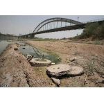
Each day, about 20,000 cubic meters of water from the Karkheh River is transferred to the Karun through Shahid Chamran Canal. Today, the Karun carries less water than it once did and can no longer support navigation. The stretch of the river from Khorramshahr to Ahvaz, about 180 kilometers long, is known as Karun Sofla.
When invading Iran on September 22, 1980, the Iraqi army, unable to cross the Arvand Rud and blocked by the strong defenses of Khorramshahr, sought to occupy Abadan by crossing the Karun River at Mared and advancing toward the Bahmanshir River.[2] The 6th Armored Brigade of the Iraqi army established a bridgehead across the Karun extending two kilometers toward the Ahvaz–Khorramshahr Road, and built a PMP floating bridge over the river. Iraqi forces then strengthened their positions east of the Karun and, after three days, seized Mared Village. The following morning, they took control of the Mahshahr–Abadan Road, effectively surrounding Abadan Island completely from the land side.
Although Iraq mainly sought to gain access to Abadan by crossing the Karun, securing the river crossings required expanding the bridgehead to the north as well. Therefore, the Iraqis pushed their positions several hundred meters northward toward the village of Salmaniya, expanding their hold in the area.[3] In this manner, the enemy occupied a key bridgehead east of the Karun River and, by expanding it, opened a route toward Abadan Island.[4]
A few days later, as Iraqi units pushed across the deserts around Abadan and advanced toward Darkhovein and Mahshahr, they installed two more bridges on the Karun between Salmaniya and Darkhovein.[5] After the enemy crossed the Karun and besieged Abadan in October 1980, three defensive lines were formed east of the river: Abadan (about 14 km), Darkhovein (about 50 km), and Mahshahr (about 7 km).[6] When Khorramshahr fell on October 26, 1980, and the Khorramshahr bridge over the Karun was destroyed, the river turned into a major natural barrier separating Iranian forces in Abadan from Iraqis in Khorramshahr.[7]
In early 1981, the Khuzestan Provincial Governorate and the Water and Power Organization created an artificial flood by digging a canal for the pumping of Karun River water to impede enemy movement.[8] North of the Ahvaz–Andimeshk Highway, a wide canal was dug from the riverbank across the northern and western approaches to Ahvaz, and water from the Karun was pumped into it by nine large pumps. The water flooded out near Dob-e Hardan, southwest of Ahvaz, turning part of the plain into marshland.[9]
In March 1981, the 77th Division of the Army took over command of the Abadan–Khorramshahr axis, and a plan to break Abadan’s siege was drawn up.[10] Under this plan, later called Operation Thamen al-Aemmah (as), the 77th Division, together with the Islamic Revolutionary Guard Corps (IRGC) units, was tasked with liberating the occupied areas east of the Karun.[11]
At dawn on September 27, 1981, Iranian forces attacked the enemy from the Zolfaqariyeh, Fayyaziyeh, and Darkhovein. After two days of fighting, they broke the siege of Abadan.[12] During the operation, two bridges (Qasbeh and Haffar) that Iraq had set up on the Karun were destroyed,[13] and the enemy was completely driven off the Karun’s east bank.[14]
In 1982, the Iraqi army did not anticipate that Iran would cross the Karun River to retake Khorramshahr, nor that the main axis of its offensive would involve crossing the Karun. Much of the western bank of the Karun was marsh and reedbed, leaving Iraqi forces with limited observation capability. On the other hand, the area between the Karun and the enemy’s primary defensive lines along the Ahvaz–Khorramshahr Road was loosely held—monitored by patrols but without a sustained presence—leaving it without a firm, continuous defensive barrier.[15] On March 29, 1982, while reviewing reconnaissance photos taken over Khuzestan by an RF-4 aircraft, analysts found that although the plane had failed to photograph Hoor al-Azim, the cameras had captured clear, valuable images of the Karun’s west bank from north of Darkhovein down to north of Khorramshahr. One of these photos showed that the enemy was absent from a specific part of the west bank. That single, high-value image revealed a gap in Iraqi lines and led to a major revision of the plan for Operation Beit al-Muqaddas, offering a real chance for success in the coming battle.[16]
The forces of two headquarters — five divisions in total — were supposed to cross the river along a wide, 40-kilometer bridgehead.[17] Five crossing points were selected for installing floating bridges. Then, in the first phase of the operation, the Army Ground Forces put five floating bridges across the Karun so that the Fath and Nasr headquarters forces could cross the river.[18]
With the installation of the “Piroozi Bridge” over the Karun on April 30, 1982, in Darkhovein, Iranians were able to cross the river, thereby paving the way for the liberation of Khorramshahr and the northern bank of the Karun on May 24, 1982.[19]
Following the Iran–Iraq War, an earth dam was constructed on the Karun River in 2021 to improve the water quality of the Bahmanshir, prevent saltwater intrusion, and enhance the drinking water supply for Abadan. The dam is 190 meters long, with a crest width of 11 meters and an approximate height of 19 meters. This embankment blocked the river, separated fresh and saltwater, and cut off the Karun’s direct connection to the Persian Gulf, thereby improving Abadan’s water quality.[20] The Karun’s water level has continued to drop in recent years, largely because water from its headwaters is being diverted to Isfahan Province.[21]
[1] Pourjabbari, Pejman, Atlas-e Joghrafiya-ye Hemaasi 1: Khuzestan dar Jang (Epic Geography Atlas 1: Khuzestan in War), Tehran: Sarir, 1389, p. 194.
[2] Ibid., Pp. 194–195.
[3] Bani-Lohe, Seyyed Ali va Digaran, Nabardha-ye Sharq-e Karun be Revayat-e Farmandehan (Battles East of Karun as Told by Commanders), Tehran: Markaz-e Motaleat va Tahqiqat-e Jang, 1379, p. 54.
[4] Ibid., p. 55.
[5] Soleimani-Khah, Nematollah, In Su-ye Arvand Jaayi baraye Dooshman Nist (There is no Place for the Enemy on this Side of Arvand), Tehran: Markaz-e Asnad va Tahqiqat-e Defa Muqaddas, 1393, p. 368.
[6] Bani-Lohe, Seyyed Ali va Digaran, Ibid., Pp. 75–76.
[7] Pourjabbari, Pejman, Ibid., p. 195.
[8] Shirmuhammad, Mohsen, Cheshman-e Oqaab: Hemaase-ye Gordan-e 11 Shenasaayi-ye Taktiki-ye Niru-ye Havaaei va Amaliyaat-e Aksbardari-ye Havaaei dar Defa Muqaddas (Eagle Eyes: The Epic of Tactical Reconnaissance Battalion 11 and Aerial Photography Operations in the Sacred Defense), Tehran: Markaz-e Enteshaarat-e Rahbordi-ye NAHAJA, 1396, p. 179; Hussaini, Yaqoub, Seil-e Masnuei baraye Padaafand dar Khuzestan (Artificial Flooding for Defense in Khuzestan), Tehran: Iran-e Sabz, 1392, p. 33.
[9] Hussaini, Yaqoub, Ibid., p. 34.
[10] Sarvari, Rouhollah and Abolqasem Javdani, Amaliyaat-e Thamen al-Aemmah (as) (Operation Thamen al-Aemmah (as)), Tehran: Nashr-e AJA, 1390, Pp. 88, 89, and 124.
[11] Ruzshomar-e Jang-e Iran va Araq, Nabardha-ye Sharq-e Karun be Revayat-e Farmandehan (Chronology of the Iran–Iraq War, Battles East of Karun as Told by Commanders), Tehran: Markaz-e Motaleat va Tahqiqat-e Jang-e Sepah-e Pasdaran, 1373, p. 175.
[12] Jafari, Mojtaba, Atlas-e Nabardha-ye Mandegar (Atlas of Lasting Battles), Tehran: Sooreh-ye Sabz, 35th Ed., 1393, p. 64.
[13] Ardestani, Hussain, Tarikh-e Shafahi-ye Defa Muqaddas, Revayat-e Seyyed Yahya Safavi, az Sanandaj ta Khorramshahr (Oral History of the Sacred Defense, Seyyed Yahya Safavi’s Account, from Sanandaj to Khorramshahr), Vol. 1, Tehran: Markaz-e Asnad va Tahqiqat-e Defa Muqaddas, 1397, Pp. 336–337; Soleimani-Khah, Nematollah, Ibid., Pp. 473–475.
[14] Pourjabbari, Pejman, Ibid., p. 195.
[15] Heydari-Muqaddam, Abbas, Hendese dar Razm, Tarikh-e Shafahi-ye Mohandesi-ye Razmi-ye Defa Muqaddas (Geometry in Combat: Oral History of Combat Engineering in the Sacred Defense), Vol. 2, Tehran: Enteshaarat-e Muze-ye Enqelab-e Eslami va Defa Muqaddas, 1398, p. 294.
[16] Abu Ali, Zahra, Afsar-e Dalsin: Khaterat-e Sarhang Muhammad-Javad Enshaaei (Officer Dalsin: Memoirs of Colonel Muhammad-Javad Enshaaei), Tehran: Nashr-e AJA, 1389, Pp. 211–212; Zakeri, Torab, Ettelaat dar Jang-e Tahmili (Intelligence in the Imposed War), Vol. 1, Tehran: Enteshaarat-e Markaz-e Amoozeshi va Pazhoheshi-ye Shahid Sepahbod Sayyad Shirazi, 1387, Pp. 470–471; Shirmuhammad, Mohsen, Cheshman-e Oqaab (Eagle Eyes), p. 212.
[17] Parvande-ye Khorramshahr: 1–Mizgerd-e Barrasi-ye Naqsh-e Niruhaye Poshtibani va Khadamati-ye Razm dar Amaliyaat-e Beit al-Muqaddas (Khorramshahr Story: 1–Roundtable on the Role of Support and Service Forces in Operation Beit al-Muqaddas), Mahnamey-e Farhang-e Paydaari, No. 4, Bahar 1388, p. 36.
[18] Ibid., p. 39.
[19] Pourjabbari, Pejman, Ibid., p. 195.
[20] Farmandar: Sakht-e Sadd-e Mared Keifiyat-e Aab-e Abadan ra Afzayesh Daad (Governor: Construction of Mared Dam Improved Abadan’s Water Quality), IRNA, 9 Tir 1400, www.irna.ir/news/84389178/
[21] Avard-e Karun 50 Darsad Kahesh Yaft (Karun’s Flow Dropped by 50 Percent), Khabar Online, 3 Mordad 1400.


